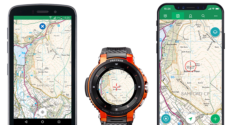
Casio partnered up with ViewRanger, the outdoor GPS app and global community for outdoor enthusiasts, to bring more maps, more routes, and navigation features to Casio Pro Trek smartwatch.
Read more Casio Pro Trek F30 Smartwatch Hit the Market in January, Here’s All that You Need to Know
The two companies have worked together on several projects over the past three years. This latest partnership brings more optimized features for CASIO Pro Trek smartwatch, including the latest WSD-F30 model that offers improved display quality and longer battery life within the smaller body so outdoor enthusiasts can explore with confidence in the outdoors, said a press release.
The ViewRanger app on the Casio Pro Trek smartwatch provides routes near their GPS location, and allows users to select and save more than 20 offline map styles. Using the app users can view maps on the smartwatch after downloading them without needing any smartwatch connection. In addition, the ability to record a track and view them on an offline map without a phone is an exclusive standalone feature for CASIO Pro Trek smart.
“Our new Wear OS app on CASIO Pro Trek smart creates an incredible adventure companion,” said Craig Wareham, CEO at ViewRanger. “Finding the right trail is quicker and simpler. The watch recommends trails near your location then explorers can download trail guide information with photos, descriptions, and maps directly to the watch. Users can also record adventures and sync them to their ViewRanger account and smartphone.”
Read more Garmin Instinct: A Rugged Fitness Smartwatch Meant for Camping, Hiking and More
With ViewRanger on a CASIO Pro Trek smartwatch, explorers can use the following smartwatch features:
Offline Maps
Offline maps can be saved on the smartwatch including worldwide street maps, terrain maps, and satellite imagery. Premium offline topographic maps of 17 countries can be downloaded and saved on the Casio Pro Trek.
Route Guides
Import routes from your ViewRanger account and discover route guides within 1.5 km of your GPS location.
Tracks and Stats
Record and track your activity, view live stats on map including altitude, distance, duration, and elevation gain/loss.
GPS and Compass
See your GPS location on maps, view your current GPS grid position. Consult digital compass and waypoint directions when following compatible route guides.


